Sky elements drones are revolutionizing atmospheric research. These unmanned aerial vehicles (UAVs) offer unprecedented access to collect data on various atmospheric phenomena, from cloud formations to air quality, providing insights previously unattainable with traditional methods. This exploration delves into the technology, applications, and future potential of drones in understanding our skies.
We’ll examine the different types of drones used, their capabilities, and the specific data they collect. We’ll also discuss the challenges involved, such as navigating regulations and dealing with adverse weather conditions. Finally, we’ll look at how the data collected is processed and analyzed to provide valuable scientific insights.
Drone Technology in Atmospheric Research
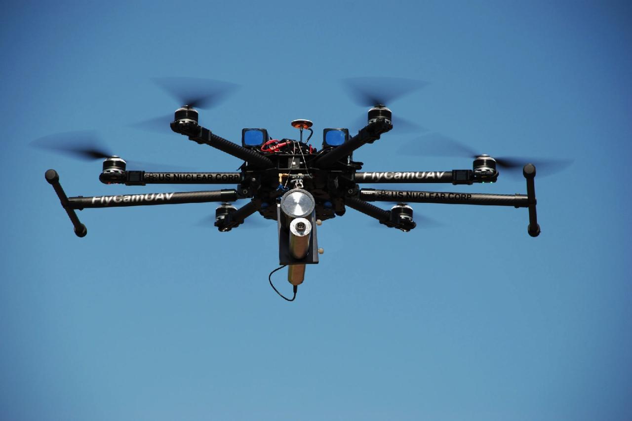
Drones are revolutionizing atmospheric research, offering a cost-effective and flexible alternative to traditional methods. Their maneuverability and ability to reach specific altitudes make them invaluable tools for collecting detailed atmospheric data.
Drone Types for Atmospheric Data Collection
Various drone types cater to different atmospheric research needs. The choice depends on payload capacity, flight duration, and altitude requirements.
| Drone Type | Payload Capacity (kg) | Flight Time (minutes) | Altitude Capability (meters) |
|---|---|---|---|
| Small Quadcopter | 1-2 | 20-30 | 100-500 |
| Larger Hexacopter | 5-10 | 45-60 | 1000-2000 |
| Fixed-Wing UAV | 10-20 | 60-120 | 3000-5000 |
| High-Altitude Long-Endurance (HALE) UAV | >20 | >240 | >10000 |
Advantages and Disadvantages of Drones in Atmospheric Research
Drones offer several advantages over traditional methods, but also have limitations.
- Advantages: Increased spatial resolution, targeted data collection, lower cost per flight compared to satellites, easier deployment than weather balloons, and real-time data transmission.
- Disadvantages: Limited flight time and range compared to satellites, susceptibility to weather conditions, regulatory restrictions, and potential for equipment malfunction.
Drone-Based Atmospheric Data Collection
Drones are equipped with a range of sensors to collect various atmospheric parameters.
- Temperature: Thermistors or infrared sensors measure temperature at different altitudes.
- Pressure: Barometric sensors measure atmospheric pressure, crucial for altitude calculations and weather modeling.
- Humidity: Capacitive or resistive humidity sensors measure water vapor content in the air.
- Wind Speed: Anemometers or ultrasonic sensors measure wind speed and direction.
Sky Element Monitoring with Drones: Sky Elements Drones
Drones are increasingly used to monitor various sky elements, providing valuable insights into atmospheric processes.
Sky Elements Monitored by Drones
- Clouds: Drone imagery helps classify cloud types, measure cloud cover, and study cloud formation processes.
- Precipitation: Drones equipped with precipitation sensors can measure rainfall intensity and distribution.
- Air Quality: Sensors can measure pollutants like particulate matter, ozone, and nitrogen oxides.
- Atmospheric Phenomena: Drones can capture images and data on events like lightning, tornadoes, and atmospheric rivers.
Challenges and Limitations of Drone-Based Sky Monitoring

Several factors can hinder drone-based sky monitoring.
Sky elements drones are becoming increasingly popular for their innovative designs and capabilities. To see some amazing drone displays in action, check out the incredible light shows at the orlando drone show , a truly spectacular event. Seeing these performances will give you a better understanding of what’s possible with advanced sky elements drones and inspire your own projects.
- Sensor limitations: The accuracy and range of drone sensors can be limited, especially at high altitudes.
- Weather conditions: Strong winds, rain, and low visibility can significantly impact drone operations.
- Data processing: Analyzing large datasets from multiple sensors requires specialized software and expertise.
Data Processing and Analysis Techniques
Effective data processing and analysis are crucial for extracting meaningful information from drone-based sky observations.
- Calibration and validation: Raw data needs to be calibrated against ground-based measurements to ensure accuracy.
- Spatial interpolation: Techniques like kriging are used to estimate data values at unsampled locations.
- Statistical analysis: Statistical methods are used to identify trends and patterns in the data.
- Data visualization: Creating maps and graphs helps to visualize the data and communicate findings effectively.
Drone-Based Imaging and Photography of the Sky
High-resolution cameras and specialized sensors mounted on drones provide detailed images of the sky for various applications.
Drone Cameras and Sensors for Sky Imaging
| Camera/Sensor Type | Resolution (pixels) | Spectral Range | Image Processing Capabilities |
|---|---|---|---|
| High-Resolution RGB Camera | 20-50 MP | Visible Light | Image stitching, atmospheric correction |
| Multispectral Camera | 10-20 MP per band | Visible and near-infrared | Vegetation indices calculation, land cover mapping |
| Thermal Camera | 1024 x 768 | Infrared | Temperature mapping, heat flux analysis |
| Hyperspectral Camera | Variable | Wide range of wavelengths | Detailed material identification, mineral mapping |
Applications of Drone-Based Sky Imagery
Drone imagery is used across various fields to study sky elements.
- Meteorology: Cloud classification, precipitation monitoring, weather forecasting.
- Astronomy: Night sky photography, aurora monitoring, atmospheric light pollution studies.
- Environmental Monitoring: Air quality assessment, wildfire detection, pollution plume tracking.
Image Enhancement and Analysis Techniques
Advanced techniques enhance the quality and information content of drone-based sky images.
- Image stitching: Combining multiple overlapping images to create a larger, high-resolution image.
- Atmospheric correction: Removing the effects of atmospheric scattering and absorption to improve image clarity.
- Image classification: Identifying different sky elements based on their spectral characteristics.
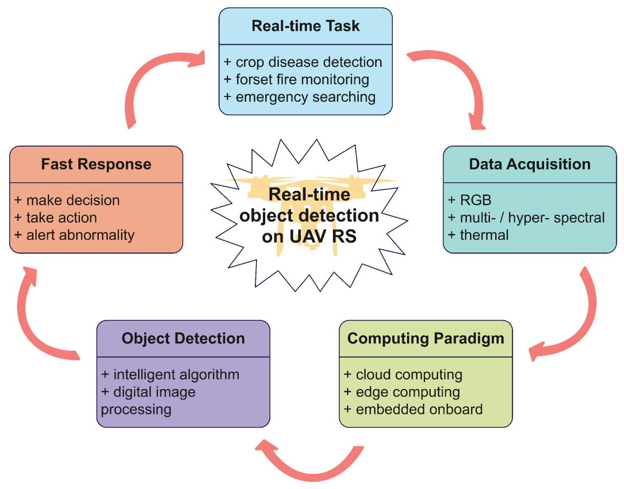
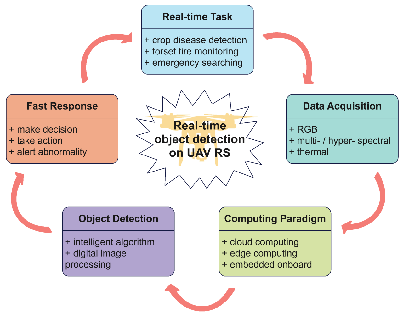
- Object detection: Identifying specific features within images, such as clouds, aircraft, or atmospheric phenomena.
Safety and Regulations for Drone Operations in the Sky

Safe and responsible drone operation requires careful consideration of safety concerns and regulations.
Safety Concerns and Regulations
- High-altitude flight: Increased risk of equipment malfunction and loss of control.
- Challenging weather: Strong winds, rain, and low visibility can lead to accidents.
- Airspace restrictions: Drones must not interfere with manned aircraft or other airspace users.
- Privacy concerns: Drone operators must respect the privacy of individuals and properties.
Airspace Management and Communication Protocols
Effective airspace management and communication protocols are crucial for preventing accidents and ensuring safe drone operations.
- Flight planning: Careful planning of flight paths and altitudes is essential to avoid conflicts with other airspace users.
- Communication with air traffic control: Operators may need to coordinate their flights with air traffic control, especially near airports.
- Use of ADS-B transponders: These devices transmit the drone’s location and altitude, improving situational awareness.
- Emergency procedures: Operators must have plans in place to handle emergencies, such as loss of control or equipment malfunction.
Permits and Approvals for Drone-Based Sky Research
Conducting drone-based sky research often requires obtaining necessary permits and approvals from relevant authorities.
- National aviation authorities: These authorities regulate drone operations and issue permits for flights in controlled airspace.
- Local authorities: Local permits may be required for operations in specific areas, such as national parks or wildlife reserves.
- Environmental agencies: Permits may be needed for research involving environmentally sensitive areas.
- Landowners: Permission must be obtained from landowners for flights over private property.
Future Applications of Drones in Sky Research
Drone technology continues to advance, opening up new possibilities for atmospheric research.
Advanced Atmospheric Research Applications, Sky elements drones
- Upper atmosphere studies: Drones are being developed to reach higher altitudes, enabling research into the stratosphere and mesosphere.
- Extreme weather event monitoring: Drones can provide real-time data on hurricanes, tornadoes, and other extreme weather events.
- Climate change research: Drones can monitor changes in cloud cover, precipitation patterns, and air quality.
Role of Artificial Intelligence and Machine Learning
AI and ML are transforming data analysis from drone-based sky observations.
Sky elements drones are becoming increasingly popular for their stunning aerial displays. If you want to see some amazing drone choreography in action, check out the spectacular light shows at the florida drone show ; it’s a great example of what’s possible with advanced drone technology. Then, consider how sky elements drones could elevate your next event with similar breathtaking visuals.
- Automated data processing: AI algorithms can automatically process large datasets, reducing the need for manual intervention.
- Pattern recognition: ML models can identify patterns and anomalies in the data, providing insights into atmospheric processes.
- Predictive modeling: AI can be used to develop predictive models for weather forecasting and climate change impact assessment.
Integration with Other Remote Sensing Technologies
Combining drone technology with other remote sensing methods enhances our understanding of the sky.
- Satellite data integration: Drone data can be integrated with satellite data to provide a more comprehensive view of atmospheric conditions.
- Ground-based sensor networks: Combining drone data with ground-based sensor networks improves spatial coverage and data accuracy.
- Data fusion techniques: Data fusion techniques combine data from multiple sources to create a more complete picture of the atmosphere.
Drone Capturing a Noctilucent Cloud
Imagine a drone silently hovering in the twilight sky, its camera lens focused on a rare celestial event: a noctilucent cloud. The scene is bathed in the ethereal glow of the setting sun, painting the sky in shades of deep blue and violet. The noctilucent cloud itself, a wispy veil of ice crystals high in the mesosphere, shimmers with an otherworldly luminescence.
Its intricate patterns, delicate filaments, and subtle variations in brightness are captured in stunning detail by the drone’s high-resolution camera. The cloud’s silvery-blue color contrasts sharply with the darker blue of the surrounding sky, highlighting its ethereal nature. The scale of the cloud is vast, stretching across a significant portion of the visible sky, yet its delicate structure is clearly visible in the high-resolution image.
The surrounding environment is dark, with only the faintest hint of starlight visible, further emphasizing the cloud’s otherworldly glow. The scene is a testament to the beauty and mystery of the upper atmosphere, captured with the precision and reach of modern drone technology.
Last Recap

The use of drones in atmospheric research is rapidly advancing our understanding of the sky. From monitoring air quality and weather patterns to capturing stunning imagery of atmospheric phenomena, drones provide a flexible and efficient tool for scientists and researchers. As technology continues to improve, we can expect even more innovative applications of drones in atmospheric science, leading to further advancements in our knowledge of the Earth’s atmosphere and climate.
Sky elements drones are changing the game, offering exciting possibilities for aerial technology. To see how this translates to real-world applications, check out the current amazon drone delivery locations , a great example of how drones are impacting everyday life. Understanding these delivery zones helps us better grasp the future potential of sky elements drones and their expanding capabilities.
Top FAQs
How long can drones stay aloft during atmospheric research?
Flight time varies greatly depending on the drone model and its payload. Smaller drones might have flight times of 30 minutes, while larger, more specialized drones can fly for several hours.
What are the main safety risks associated with operating drones for atmospheric research?
Key risks include loss of control due to technical malfunctions or weather, collisions with other aircraft or obstacles, and potential damage to the drone or its payload.
What kind of permits are typically needed to fly drones for research purposes?
Permits vary by location and airspace regulations. You’ll generally need to register your drone, obtain necessary airspace authorizations, and possibly comply with specific research permits depending on the project’s scope and location.
How expensive are drones used for atmospheric research?
Costs range significantly depending on the drone’s features, payload capacity, and sensor technology. Basic models can cost a few thousand dollars, while specialized research drones can cost tens of thousands or even more.
